Click here for full screen map
Mapping Adereon: A Fantasy Cartography Project
By Ian Spangler
The known landmasses of Adereon have never been mapped – until now.
Over the past two years, I have been playing quite a bit of Dungeons & Dragons
My friend Nate is in the process of homebrewing his own universe, and I thought it
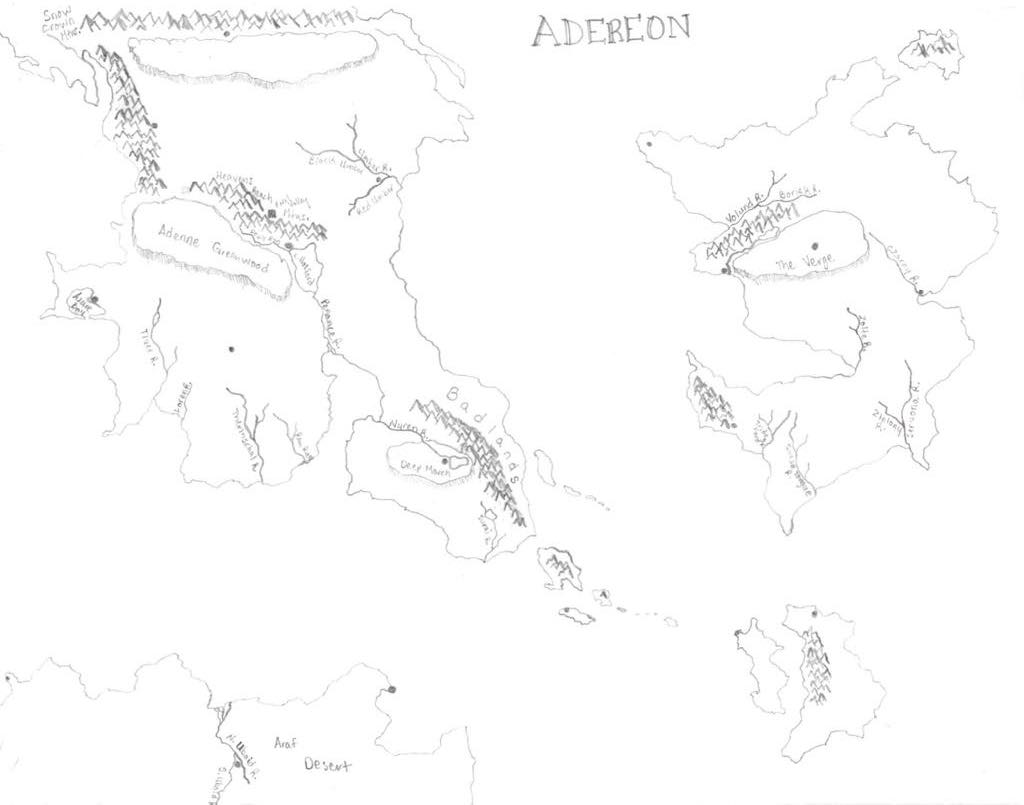
would be a fun exercise to digitize the maps that he had drawn (see Figure 1).
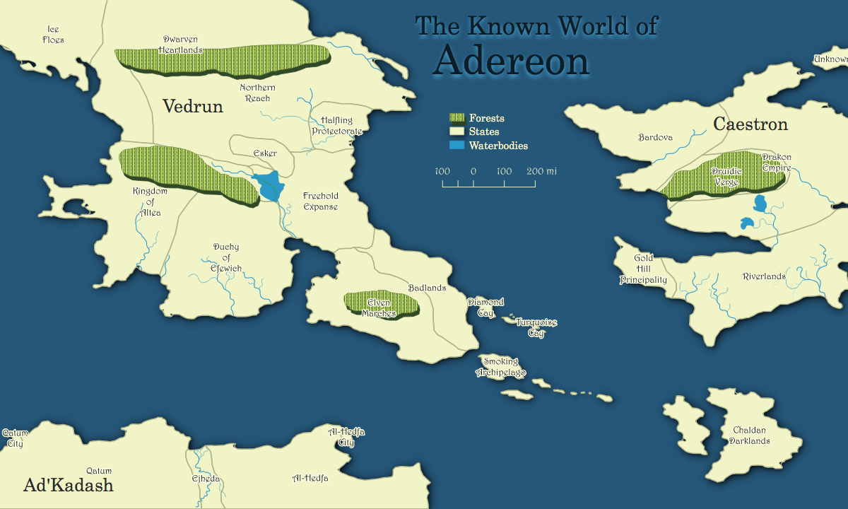
The above map represents the cartographic fruits of my labor. Making this map involved
three steps, more or less: 1) choosing a coordinate system and projection; 2) georeferencing;
and 3) digitizing. I chose to project this data on to the moon, because that was a closer approximation
of the globe that Nate envisioned than our Earth is. Nate provided me with two maps – one of topographic
features and one of political boundaries – which I had to georeference with one another. Digitizing was
straightforward but arduous. I spent far more time trying to design a workflow for vectorizing the
hand-drawn maps that Nate provided, and it worked but not well (that process is detailed in my methodology below).
The total contents of the map include a few forests, some rivers, and the countries &
continents of Adereon (which is the name of this imaginary world). While Nate included mountains
on his original map, I had trouble representing them cartographically without generating a raster, and
that was beyond the scope of this project.
I had a vision for this project that was much larger than I could actually carry out. I wanted to
complete three other things: 1) create a flow map using the QGIS Flow Mapper plugin of political alliances, 2)
digitize data for a city, and 3) publish this as a slippy map that could be explored, zoomed into, and scrolled throug. Still, in the course
of this project I created the rough, first draft of a dataset that can be revisited and continously updated
as my D&D group explores this territory. In the future, I'll hopefully be completing those updates as I'm able,
and adding other bits of infill such as roads, mountains, and more detailed rivers.
Thanks for reading!
A detailed account of the methodology, including my failed attempt at automating the workflow, can be found here.
 methods
Figure 1: This is the original map of Adereon, drawn by my friend Nate. Note the differences in size, which I changed during the georeferencing process.
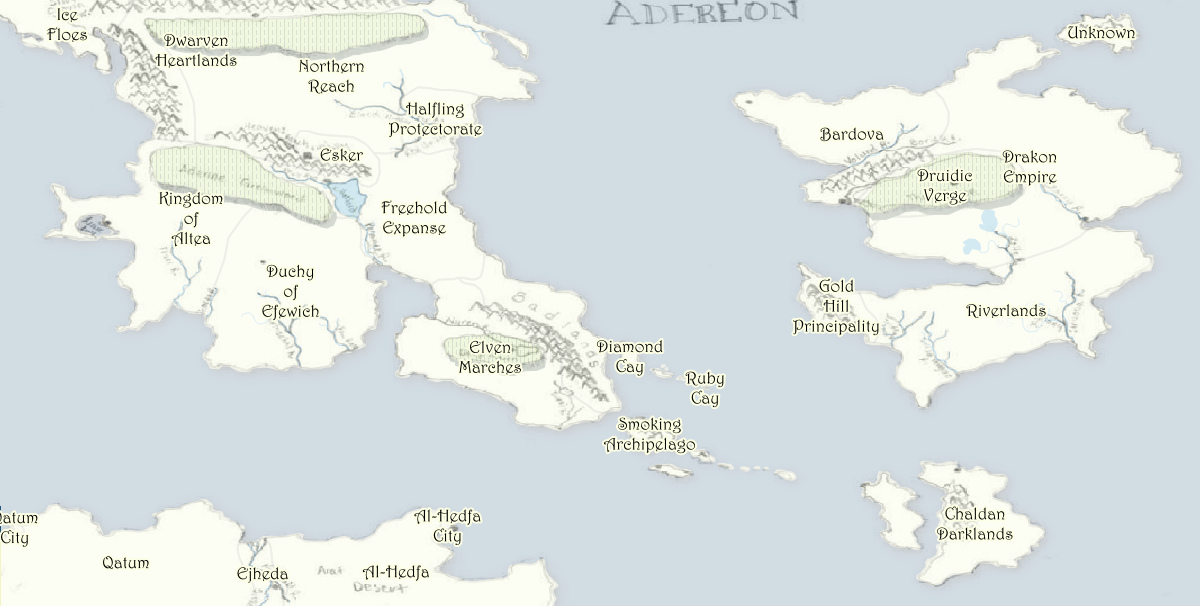
Figure 2: This shows the georeferences version of Nate's map overlaid option the map I created in QGIS. In some ways I prefer this version, for its blend of physical and digital cartography. A higher resolution image can be found here.
How was this map made?
This map was made in QGIS 3.4 on MacOS 10.13.1. It is projected in IAU2000:301000. It utilized data from the USGS Lunar GIS FTP site, and my friend Nate's imagination.University of Kentucky New Maps Plus, Fall 2018.
- Follow me on twitter @itspangler
- Visit my Github account @itspangler
- New Maps Plus